In this blog, our regional Blue Deal partner Tegenu Zerfu Tsige shares his experiences during a visit with Dutch partner experts to the Afar region in January 2026, offering a vivid account of local realities, challenges and experiences.
“The morning sun had just begun to rise, yet its heat already pressed heavily on us as we crossed the shimmering plains of the Lower Awash. A newly constructed road led us toward Asayita and Afambo. Clean, quiet and safe, cutting through a landscape that has never been simple. Every few kilometers, the terrain revealed silent markers of its past: vast plains shaped by violent flash floods, heatwaves trembling above the earth, isolated dome‑shaped wooden houses standing defiantly against the emptiness, and a horizon so open it seemed to carry the region’s long history of struggle, resilience, and hope.
Here, water is never simply water, it is a force, a memory, a fear, and at times, an absence that lingers in the air like a ghost.
Afambo & Asayita: where water is both life and a threat
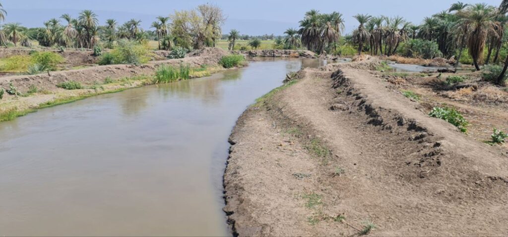
Travelling toward Afambo, near the end of Awash River, the Awash river lies perfectly still. The scene appears peaceful, almost gentle, but the driver who is part of the community, quickly reminds us how deceptive that calm can be.
“This river does not warn twice,” he murmurs, his eyes fixed on the water. “It rises like an angry guest and leaves like a thief.”
The driver explains that floods arrive without warning, rushing over fields and homes with a violent force, only to disappear again and then leave months of drought. These communities live in a constant state of tension and uncertainty, never sure whether to prepare for too much water, or too little.
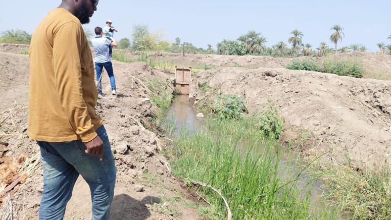
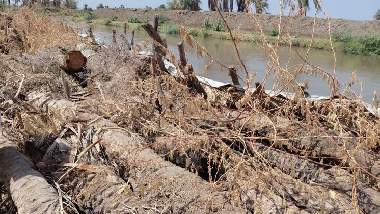
Along the riverbanks, we see clear signs of years of intervention: dredged channels deepened beyond their natural form, dikes repeatedly patched, and flow‑control structures intended to protect but quietly reshaping the river’s behavior. These works can reduce flooding temporarily, but they also disconnect the river from its flood plain, accelerate sediment movement, and sharpen hydraulic drought for smallholders downstream.
Further along these fields, we recognise more issues:
- diversion points built in the wrong place
- poorly aligned and weakened dikes
- unmeasured abstractions pulling water unpredictably
- salt crusting over waterlogged soils
- invasive weeds claiming canals
One elder pointed toward the sluggish river and said softly: “Hydraulic drought is not when water is gone. It is when water passes you, but refuses to work for you.” His words capture the contradiction: water visibly flowing past, yet most irrigation blocks remain unable to access it.
A traditional governance system
As we continue our conversation, another dimension of this region emerges: not defined by terrain, but by people and their social fabric. Within the Afar community, clan structures operate under a governance system that is seldom formally recognised by outsiders, yet it functions with remarkable coherence and authority.
At the heart of this system is maa’da, the Afar customary law. It is not written in any document or codified in legal texts; instead, it lives in collective memory, shared responsibility, and the wisdom of elders. These elders, carrying decades of lived experience, serve as custodians of justice and social order. Their decisions, shaped by deep cultural understanding, guide community life in ways that external observers often overlook.
We learned how responsibilities are structured with quiet clarity:
Makaban: the elder
– Respected not for his title, but for wisdom, fairness and age
– Leads negotiations, directs labour, and holds the moral authority of the clan.
Fi’ima: the middle generation
– Trusted middle-aged men who enforce decisions, organise communal work and act as intermediaries between the elder generation and the youth.
Ukubala : the youth
The strength of the system. They reinforce dikes, clear canals, patrol grazing boundaries, and mobilize immediately when the river threatens to break its banks.
No written protocol exists, yet the system is efficient: the Makaban speaks. The Fi’ima relay the message. Household clusters mobilise within hours. If a dispute arises over water, grazing, canal access, or boundaries, everyone gathers beneath a tree. Memory, precedent, and negotiation guide the conversation. Honour carries more weight than punishment.
“A rule written on paper can be torn,” an elder said. “A rule written in the mind cannot be erased.”
Discussions beneath the palm tree and a newly built dike
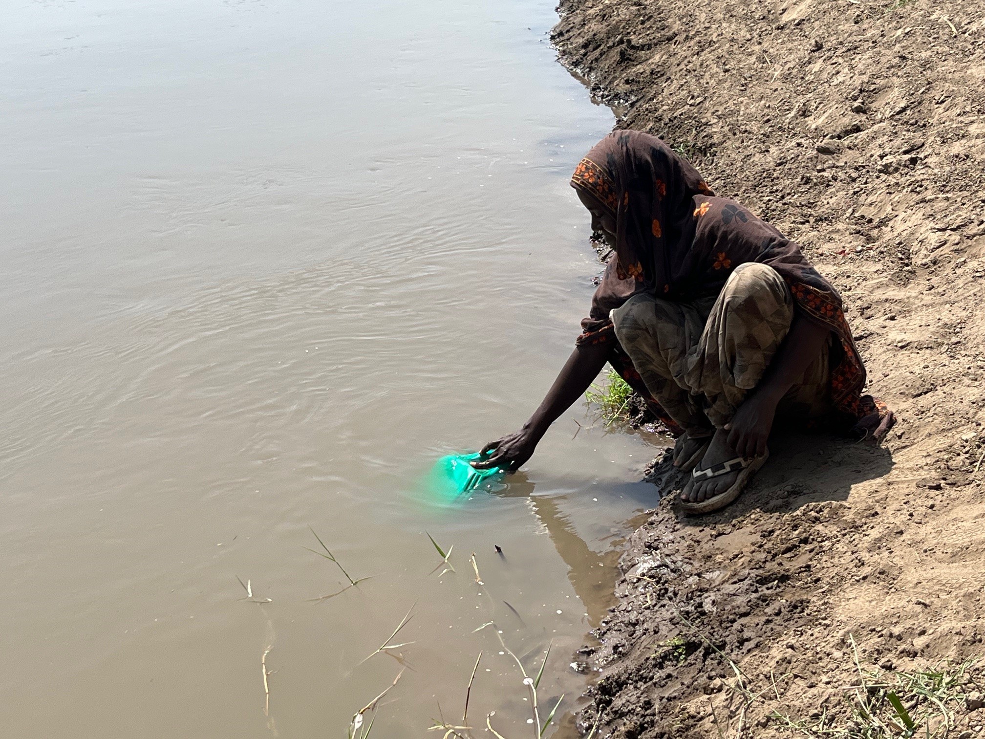
Also today, we gather beneath the shade of an old palm tree, beside a newly constructed but already eroded dike. Near us, a young girl bends down to collect water for her household. The ground around her is dusty, the dike crumbling at its edges a reminder of both the river’s force and the community’s ongoing struggle to protect their land.
As I stood there observing, I began asking simple questions: Who built this structure? Why was it built this way? What does it mean for the people who rely on it? These questions open a door. Slowly at first, then with growing intensity, concerns begin to surface. The elders, who had been listening quietly, eventually stepped forward more direct, more emotional, and unmistakably frustrated.
They explain that a technical study was conducted, machinery mobilised, and a contractor brought in. But all of it happened without genuine consultation in the community. The process overlooked the very people who depend on the river and the dike for their survival. “They finished the work and left,” one elder said. “Then the river broke through. And when the water came, we were the ones who had to fix it with our own hands, with our own governance system, with whatever materials we could gather.”
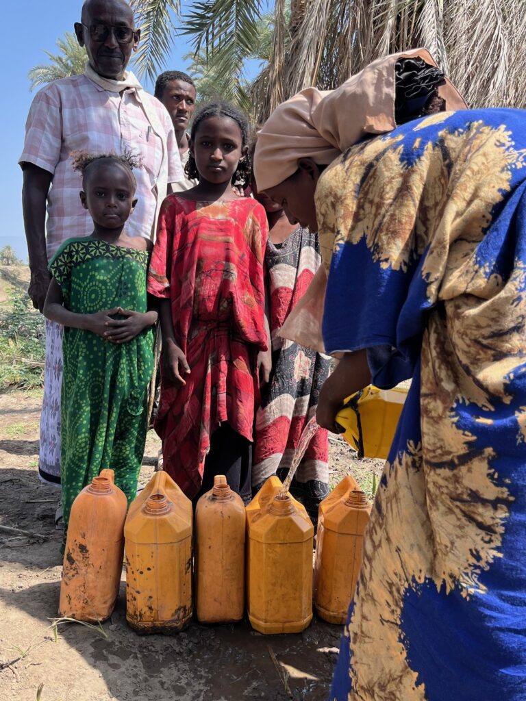
Despite limited resources, the community came into action. They rebuilt what they could: using old palm trunks as support columns, weaving palm leaves, gathering soil, organising labor through their clan system. They showed us how they even construct infiltration wells near the riverbank simple structures that cool and filter water for drinking when the river runs too muddy to use.
“We can do it,” another elder said. “But the river’s power is sometimes beyond our capacity. Still, we work. We organise ourselves. We don’t wait.”
He pauses, looking toward the damaged fields. When the river last breached the dike, it destroyed 120 hectares of land fields that families depended on. Then he adds quietly, “It would be better if our voices were truly heard. We are the beneficiaries. We live here. Sustainable dikes require our knowledge, our experience, our involvement.”
Later, another elder summarises it in a single sentence that captured the spirit of the community:
“If we wait for others, the river will move before they do. So we stand with our hands, our shovels, and our unity.”
Toward the silent edge of Awash and beyond
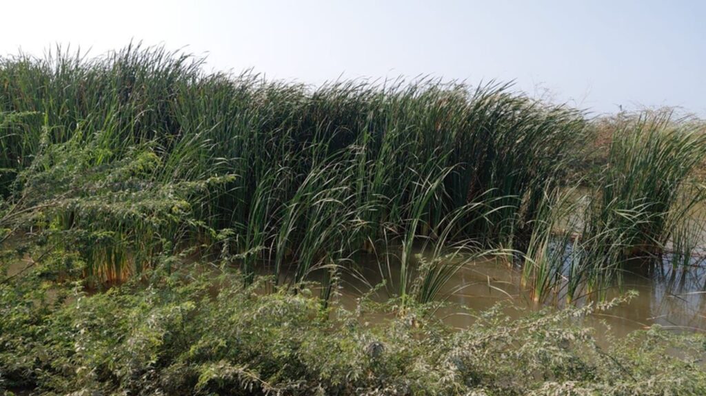
Later in the afternoon, our journey takes us further east, toward the far end of the Awash river where its long course empties into Lake Gemeri. The noise of the world slowly fades behind us. The wind settled. We see a vast wetland system that feels almost untouched. Tall grass sways. Birds hop, whistle, and dance between the reeds. Children splash near the shore, washing clothes and cooling themselves under the soft light. The entire setting feels like a healthy ecological pocket, an environment where water, land, and human life still move in harmony.
Toward the Djibouti border where two countries meet
As we drive east near the Djibouti border, the elders point out riverbeds that had flowed decades earlier, but are now dry and silent. The terrain itself tells the stories, quiet but full of clues about past hydrological forces. Reaching the border feels like arriving at a natural T‑junction where two sisterly countries meet, connected by boundaries and shared history and intertwined livelihoods. The land here carries a peculiar stillness, yet the landscape speaks volumes about what once was and what could return if ecological systems are preserved and cross‑border cooperation strengthened.
A gesture of hospitality
On our return from the trip, the Woreda Water and Irrigation Head honours us with a warm and dignified lunch. The genuine and respectful and inclusive hospitality, beautifully accommodated both Muslim and Christian customs around the same table. It was more than a meal; it was a cultural bridge, a symbol of unity and shared purpose.
From the eroded dikes maintained through local governance, to the peaceful wetlands of Lake Gemeri, to the striking silence of the Djibouti border every place revealed something deeper. It showed how water shapes lives, cultures, economies, and ecosystems. And how communities, even with limited tools, hold centuries of knowledge about adapting, surviving, and sustaining their environment.
Day 2. A landscape of opportunity and challenge: the Dubti–Tendaho corridor
As we continued our journey through the Dubti–Tendaho area, the landscape opened into a wide expanse of plains—fertile land once shaped by the Awash River’s seasonal floods, now increasingly transformed for modern irrigation. The Tendaho Dam, standing upstream, offers immense potential: stabilizing flows, supporting wheat production for national programs, and enabling large-scale commercial agriculture. Well,‑organized settlements stretch along the plains, inhabited by both local Afar communities and technical staff working in the sugar estate. Compared to the downstream basin, this area feels more developed equipped with irrigation infrastructure, accessible roads, and visible signs of agricultural ambition.
But the picture is not without its complexities. Salinity patches shimmer on some fields, a warning of long-term soil stress. Market chains remain uncertain, and many farmers worry whether the available water will be enough once the entire command area becomes fully cultivated. Downstream users raise similar concerns: how will dam releases be managed, how will maintenance be ensured, and what happens during peak flood months when the river challenges even the most carefully engineered systems?
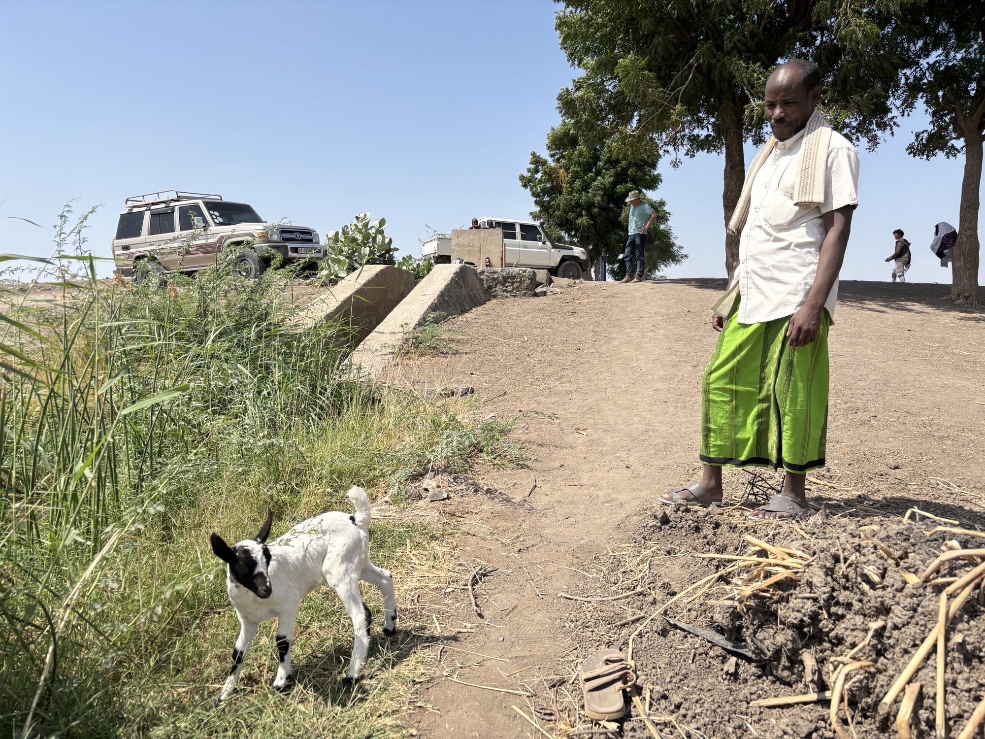
Along the roadside, we encountered a man carrying a tiny goat only a few weeks old tucked in the crook of his arm, heading to the market. The sight startled my Dutch colleagues, yet for the locals it was an ordinary expression of daily life, resilience, and livelihood strategies rooted in pastoral culture.
The Woreda office head, proud of the region’s potential, walked us through the area with great enthusiasm. He emphasized that with proper water administration, Dubti could become a model of modernized agriculture in the Awash Basin. We observed aqueducts, concrete turnouts, and well-designed irrigation structures—evidence of thoughtful engineering. Yet many secondary canals were clogged with weeds, and silt had begun to accumulate in key distribution points. Water allocation remained inconsistent, and communication between upstream operators, district technicians, and water users was often fragmented.
“For now, the water is enough,” one technician explained, “because much of the irrigable land is still idle. But once everything becomes active, water stress will be inevitable.” His words reinforced the urgency: this is precisely the time to establish a strong, coordinated water administration system—one capable of balancing demand, measuring abstraction, planning releases, and protecting both upstream and downstream users.
The Dubti–Tendaho corridor stands at a crossroads. Its potential is undeniable, but so are its risks. And as we drove onward, past fields of wheat, over canals lined with grass, and through communities carrying both hope and uncertainty, it became clear that the future of this landscape will depend not only on infrastructure, but on governance, communication, and a shared commitment to sustaining the river that runs through them all.
A basin at a crossroads
Across the basin, evidence of stress within the environment was impossible to miss:
- uncontrolled abstraction
- unpredictable floods
- longer dry spells
- rapid irrigation expansion
- land‑use change
Challenges now coexist with opportunities: invasive species spreading, salinity quietly expanding, grazing lands shrinking, yet markets opening, knowledge growing, and communities adapting in real time.
Everything seen, heard, and felt in these two days settled deep in the hearts of the team members.
Heading into the workshop in Semera, all carried dust on their shoes – and the voices of the people in their minds.
The Semera workshop
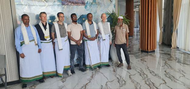
When the participants entered the Yangudi International Hotel for a workshop to discuss the issues they had witnessed during their field visit, the atmosphere felt heavy with responsibility, yet earnest and quietly hopeful, as if everyone sensed that the next hours could shape the basin’s future. Around the room, familiar faces carried their own stories: the Branch Office Head whose eyes reflected years of navigating the basin’s pressures, Afar Bureau officials standing firm in their determination to advocate for their communities, and the Dutch water experts, humbled by the realities they had witnessed during the field visit, now ready to listen, learn, and to navigate collaboration points. This wasn’t a meeting, it was a crossroads.
Partnership manager Rens Huisman opened with the message that set the tone: “Fair share for all”, the motto of the Blue Deal Awash Partnership in water allocation and an aspiration carried from the fields into the conference hall.
As each partner spoke, the room shifted from presentations to confessions, confessions of gaps, of failures, of the collective desire to do better: That data was missing. That institutions were overstretched. That customary law held wisdom regulators had yet to honor. That downstream voices had remained too quiet for too long.
Yet beneath those confessions was something powerful: a shared willingness to rebuild trust, to learn from mistakes, and to move forward together. And as groups formed around tables, the energy transformed. Maps were spread out, markers uncapped, hands animated. The fatigue of travel and long field days melted into lively argument and laughter.
One group spoke passionately about building IWUAs – “not as paperwork, but as bridges between conflict and cooperation.”
Another debated the need for real-time monitoring—“data means nothing unless the farmer understands what it means for tomorrow’s irrigation.”
A third group dreamed of universities stepping into the heart of basin issues -“because knowledge must stand shoulder-to-shoulder with communities.”
Slowly, the chaos turned into clarity:
- From data to integration
- From voices to inclusion
- From institutions to collaboration
The basin’s story, once fragmented, began to weave itself into a shared narrative.
A Moment That Became a Memory
As the workshop drew to a close, an unexpected moment unfolded. Officials from the Afar Water and Energy Bureau stepped forward carrying beautifully folded traditional Afar cultural clothes. When they placed the garments on the Dutch team embroidered, warm, symbolic the reception space fell silent.No slide, no graph, no report could have spoken louder.
It was a gesture that meant:
“You have walked our land. You have listened to our people. Now you are part of our story.”
In that moment, the partnership transcended technical roles. It became human. A commitment sealed not by signatures, but by respect.
What the basin needs now: recommendations emerging from the journey
The conversations with elders, officials, irrigators, pastoralists, and technical staff made one message unmistakably clear: sustainable water allocation cannot be engineered from an office desk alone. It must be built from the ground up through understanding, coordination, trust, and shared responsibility.
The basin now needs:
A deeper understanding of the whole system: Not just hydrology, but the social, economic, and cultural systems that shape water decisions. Both natural flow processes and human‑made dynamics must be understood together, not separately.
Clear mapping of users and institutions: Who takes water, where, when, and under what rules? Without clarity, fairness becomes impossible and conflict becomes inevitable.
A governance system built on connection, not competition: Formal and informal systems must not stand in parallel lines. They must intertwine, share information, and build a collaborative culture from basin to kebele.
Recognition of customary governance: Systems like maa’da are not informal gaps in governance they are functioning structures that guide daily life. Any water‑allocation system that ignores them will fail before it begins.
Bridges between clan structures and formal IWUAs: These two systems do not have to compete. In fact, the basin’s stability relies on them connecting, coordinating, and reinforcing one another.
Transparent communication on Tendaho Dam releases and administration: Communities repeatedly raised concerns about unpredictable flows. Clear, timely, and open communication must become standard practice.
Reliable measurement at abstraction points: Without accurate data, there can be no planning, no fairness, and no accountability.
Protection of ecological flows and pastoral grazing zones: Wetlands, lakes, and floodplains provide life far beyond their borders. Protecting them is not optional—it is foundational for long‑term sustainability.
Climate smart agriculture and livelihood improvement